
Choix le plus populaire

Amazon.be Marketplace· Marketplace
€ 71,15
3 à 4 joursLivraison gratuite
Check de website voor de levertijd | Gratis bezorgd > €20,-


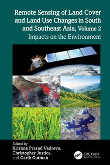
Volume 2 of Remote Sensing of LCLUC in South and Southeast Asia handbook explores the complex, dynamic interactions between land use, development, and the environment in the region. With contributions from NASA and regional experts, it highlights the transformative power of remote sensing and ML while calling stakeholders to action.
South and Southeast Asian countries are experiencing rapid land cover and land use changes (LCLUC) driven by urbanization, agricultural expansion, deforestation, and infrastructure development. These transformations have significant impacts on biodiversity, water resources, food security, and climate regulation. There is an urgent need to quantify LCLUC impacts to design effective management strategies that help understand, mitigate, and adapt to these changes. Remote sensing data plays a crucial role in providing diverse information essential for assessing land use patterns, quantifying changes, and evaluating both environmental and societal impacts.
Volume 2 explores the complex and dynamic interactions between land use and the environment in the region. It brings together expertise from U.S. contributors of the NASA-funded Southeast Asia Research Initiative (SARI) and collaborators from South and Southeast Asian countries.
This book highlights the transformative power of remote sensing and geospatial technologies while calling researchers, policymakers, and practitioners to action. It offers valuable insights for scientists, geographers, ecologists, remote sensing specialists, and anyone interested in the intersection of land use, development, and environmental sustainability.
Tu possèdes ce produit et tu aimerais donner ton avis ? Commence ci-dessous à écrire ton avis. Selon le niveau de détail, écrire un avis prend en moyenne entre 3 et 10 minutes. Avec ton opinion, tu aides les autres visiteurs à faire un meilleur choix et tu tentes chaque mois de gagner 250 € ! Clique ici pour les conditions de l’action.
