

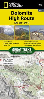
Dolomite High Route (Alta Via 1) Carte 1:25.000 Italie
Nous n’avons trouvé aucun prix pour ce produitHeureusement, nous avons trouvé de bonnes alternatives pour toi : tu les trouves plus bas sur la page.
Produits similaires ou meilleurs
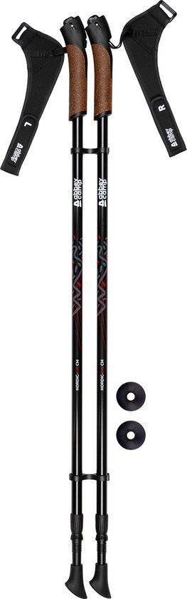
Abbey Camp Bâtons de marche nordique - Télescopique réglable - Noir - Paire
Voir le produitVoir le produitJa|Twistlock|500 g|staal
v.a. € 27,98
NILS NW8613 Bâton de marche nordique - Fibre de carbone - Poignée ergonomique - Réglable
Voir le produitVoir le produitJa|Flicklock|Staal|150 g
v.a. € 57,99
-27%
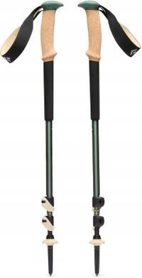
Black Diamond Trail Cork Bâtons de randonnée - Réglable et confortable
Voir le produitVoir le produitJa|Flicklock|625 g|Carbide
v.a. € 84,99
-11%
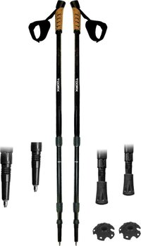
Toorx Bâtons de marche nordique - Réglable télescopique - Paire - Noir/Liège
Voir le produitVoir le produit6 cm|1,35 m|8 cm|Kurk
v.a. € 28,95
- Ajustable
- Système de fermeture
- Poids de l'emballage
- Type point
- À partir de
- Ja
- Twistlock
- 500 g
- staal
- v.a. € 27,98Voir le produit
- Ja
- Flicklock
- 150 g
- Staal
- v.a. € 57,99Voir le produit-27%
- Ja
- Flicklock
- 625 g
- Carbide
- v.a. € 84,99Voir le produit-11%
Productinformatie
- Adapté au sèche-linge
- Non
- EAN
- 9781566959254
Opties en functies
- Volets réglables
- Non
Overige kenmerken
- E-mailadres verantwoordelijke marktdeelnemer in de EU
- sales@ngi.be
- Verpakking breedte
- 11,3 cm
- Verpakking hoogte
- 0,3 cm
- Verpakking lengte
- 23,5 cm
- Verpakkingsgewicht
- 91 g
Technische specificaties
- Product lengte
- 0,3 cm
Description du produit
- Waterproof - Tear-Resistant - Topographic MapThe Alta Via n. 1 (High Route One) of the Dolomites is considered to be the most beautiful classic route in the entire Dolomite territory.- It connects Lake Braies with Belluno, winds along a route of approximately 125 kilometers (78 miles), with 7,300 meters (23,950 feet) of altitude difference in 12 stages.- The route cuts from north to south and is normally followed starting from Braies.- The Alta Via n.- 1 crosses five different mountain groups: the Braies Dolomites, the Fanes Group (Fanis), the Ampezzo Dolomites, the Northern Dolomites of Zoldo, and the Southern Dolomites of Zoldo.The Dolomite Topographic Map Guide booklet makes a perfect traveling companion when traversing these routes. A detailed description of each trail section is included that tells travelers about the many landmarks encountered along the way.Every Great Treks map is printed on "Backcountry Tough" waterproof, tear-resistant paper. A full Lat/Long grid is printed on the map to aid with GPS navigation. Every map purchase helps support the National Geographic Society, an impact driven, nonprofit organization with global reach that uses the power of science, exploration, education, and storytelling to illuminate and protect the wonder of our world.- Folded Size = 4.25" x 9.38"
Aucun avis n’a encore été écrit
Question 1 sur 4
Tu possèdes ce produit et tu aimerais donner ton avis ? Commence ci-dessous à écrire ton avis. Selon le niveau de détail, écrire un avis prend en moyenne entre 3 et 10 minutes. Avec ton opinion, tu aides les autres visiteurs à faire un meilleur choix et tu tentes chaque mois de gagner 250 € ! Clique ici pour les conditions de l’action.